Services > Land Surveying
Surveying
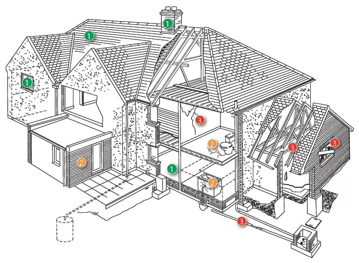
Nottinghamshire Landmark Assessments provides expert land surveying services to guide development, construction, and land management with precision and reliability. Our certified surveyors use advanced tools like GPS, LiDAR, and drone mapping to conduct boundary delineations, topographic surveys, and construction layout measurements. We accurately map terrain, identify easements, and assess site constraints—delivering the critical data architects, engineers, and developers need to optimize designs, resolve disputes, and ensure regulatory compliance.
Beyond measurements, we analyze geospatial relationships, drainage patterns, and land use potential to minimize risks and maximize project efficiency. Whether supporting urban planning, infrastructure projects, or environmental assessments, our detailed surveys transform raw land data into actionable insights. Trust Nottinghamshire Landmark Assessments to provide the accuracy and expertise your project demands, ensuring every decision is grounded in certainty.

Land Surveyor
Land surveyors are the cornerstone of precise geospatial data, blending science, technology, and legal knowledge to shape the built environment. At Nottinghamshire Landmark Assessments, our surveyors are highly skilled professionals who master geodesy, engineering principles, and advanced mathematics—translating complex measurements into actionable insights. Their expertise extends beyond fieldwork; they interpret legal boundaries, assess terrain dynamics, and leverage cutting-edge tools like GNSS receivers, 3D laser scanners, and drone-based LiDAR to deliver millimeter-accurate results.
What sets a professional surveyor apart is their ability to synthesize data into clarity. They navigate zoning laws, identify subsurface risks, and optimize land use through GIS and surveying software—ensuring every project adheres to regulatory and environmental standards. Whether guiding infrastructure development or resolving property disputes, our team transforms raw data into reliable solutions. Trust Nottinghamshire Landmark Assessments to bring technical precision, problem-solving acumen, and a commitment to excellence to your next project.

Land Measurement
Accurate land measurement combines advanced technology with scientific rigor to establish reliable spatial data for any project. Surveyors employ specialized instruments like robotic total stations, GNSS receivers, and 3D scanners to capture precise angles, distances, and elevations - applying principles of geometry, trigonometry, and physics to transform raw measurements into actionable insights. These techniques enable critical services including cadastral mapping for property records, volumetric calculations for earthworks, and detailed terrain models for engineering designs, all while meeting strict legal and regulatory standards.
Beyond data collection, modern measurement integrates digital tools like GIS mapping and surveying software to analyze land characteristics and identify potential constraints. This process supports everything from construction staking and infrastructure alignment to environmental monitoring and land use planning. By delivering comprehensive metrics on boundaries, gradients, and surface features, professional land measurement provides the factual basis for sound project planning and risk mitigation across all scales of development.
Services > Land Surveying

Surveying
Nottinghamshire Landmark Assessments provides expert land surveying services to guide development, construction, and land management with precision and reliability. Our certified surveyors use advanced tools like GPS, LiDAR, and drone mapping to conduct boundary delineations, topographic surveys, and construction layout measurements. We accurately map terrain, identify easements, and assess site constraints—delivering the critical data architects, engineers, and developers need to optimize designs, resolve disputes, and ensure regulatory compliance.
Beyond measurements, we analyze geospatial relationships, drainage patterns, and land use potential to minimize risks and maximize project efficiency. Whether supporting urban planning, infrastructure projects, or environmental assessments, our detailed surveys transform raw land data into actionable insights. Trust Nottinghamshire Landmark Assessments to provide the accuracy and expertise your project demands, ensuring every decision is grounded in certainty.
Land Surveyor
Land surveyors are the cornerstone of precise geospatial data, blending science, technology, and legal knowledge to shape the built environment. At Nottinghamshire Landmark Assessments, our surveyors are highly skilled professionals who master geodesy, engineering principles, and advanced mathematics—translating complex measurements into actionable insights. Their expertise extends beyond fieldwork; they interpret legal boundaries, assess terrain dynamics, and leverage cutting-edge tools like GNSS receivers, 3D laser scanners, and drone-based LiDAR to deliver millimeter-accurate results.

Land Measurement
Accurate land measurement combines advanced technology with scientific rigor to establish reliable spatial data for any project. Surveyors employ specialized instruments like robotic total stations, GNSS receivers, and 3D scanners to capture precise angles, distances, and elevations - applying principles of geometry, trigonometry, and physics to transform raw measurements into actionable insights. These techniques enable critical services including cadastral mapping for property records, volumetric calculations for earthworks, and detailed terrain models for engineering designs, all while meeting strict legal and regulatory standards.
Beyond data collection, modern measurement integrates digital tools like GIS mapping and surveying software to analyze land characteristics and identify potential constraints. This process supports everything from construction staking and infrastructure alignment to environmental monitoring and land use planning. By delivering comprehensive metrics on boundaries, gradients, and surface features, professional land measurement provides the factual basis for sound project planning and risk mitigation across all scales of development.
Chartered Surveyor Services in Nottinghamshire


GPS Land Surveying
We get it - when you're planning a construction project or settling a property dispute, the last thing you need is guesswork. That's why our team lives and breathes GPS surveying technology. Picture this: we're out in the field with our high-tech GNSS receivers, pulling in real-time satellite data like it's our favorite radio station. But instead of music, we're getting centimeter-accurate positioning that makes old-school measuring tapes look like relics. Whether we're marking boundaries for your new home or mapping out a commercial site, this tech lets us work faster and smarter while keeping those razor-sharp precision standards you need for legal and engineering purposes.
Here's the best part - we don't just hand you raw coordinates and call it a day. Our team blends this GPS magic with other tools to create 3D terrain models that actually make sense for your project. We've helped farmers optimize their fields, builders stake out perfect foundations, and environmentalists track landscape changes - all thanks to this game-changing technology. And because we know time is money, we've mastered techniques like RTK that deliver trustworthy results without keeping you waiting. When you work with us, you're not just getting data - you're getting a partner who understands how to turn those numbers into real-world solutions.
Need to get in touch?
Chartered Surveyor Services in Nottinghamshire
Free Estimate In 3 Easy Steps

Request a Free Quote
Request a free estimate by either calling our friendly dispatch center, open 24 hours at 07871516899, or complete our short quote request form to have one of our estimators contact you to schedule a time to survey the job.
![[keyword]](https://assets.cdn.filesafe.space/uunMD7w2Gr9QA02YyNCH/media/64ad9732-c178-43ef-8c1d-548aa514b97d.png)
Get Your Survey Done!
At the agreed time, our expert surveyor will visit your property to carry out a thorough survey, ensuring every detail is carefully examined.

![[keyword]](https://assets.cdn.filesafe.space/uunMD7w2Gr9QA02YyNCH/media/edbdc788-a070-4c22-851a-53dbbff60c0d.png)
Post-Survey Communication!
Following the survey, we'll provide a verbal summary of key findings. Within a few days, you'll receive a detailed written report tailored to your specific surveying needs.
Free Estimate
In 3 Easy Steps
Request a Free Quote
Request a free estimate by either calling our friendly dispatch center, open 24 hours at 07871516899, or complete our short quote request form to have one of our estimators contact you to schedule a time to survey the job.
![[keyword]](https://assets.cdn.filesafe.space/uunMD7w2Gr9QA02YyNCH/media/4604724e-da53-44cd-bfaf-d9e2a29f049e.png)
Get Your Survey Done!
On the appointed date our RICS Chartered Surveyor will thoroughly inspect the property's condition, structure, and any potential issues.
![[keyword]](https://assets.cdn.filesafe.space/uunMD7w2Gr9QA02YyNCH/media/5e5d00ae-e683-44c8-a55f-3e5913208296.png)
Report Delivered
After the job is surveyed, you will receive a written estimate via text outlining the job details and the cost. Just reply back with your acceptance and we'll contact you to schedule the job to be completed when it is convenient for you.


GPS Land Surveying
We get it - when you're planning a construction project or settling a property dispute, the last thing you need is guesswork. That's why our team lives and breathes GPS surveying technology. Picture this: we're out in the field with our high-tech GNSS receivers, pulling in real-time satellite data like it's our favorite radio station. But instead of music, we're getting centimeter-accurate positioning that makes old-school measuring tapes look like relics. Whether we're marking boundaries for your new home or mapping out a commercial site, this tech lets us work faster and smarter while keeping those razor-sharp precision standards you need for legal and engineering purposes.
Here's the best part - we don't just hand you raw coordinates and call it a day. Our team blends this GPS magic with other tools to create 3D terrain models that actually make sense for your project. We've helped farmers optimize their fields, builders stake out perfect foundations, and environmentalists track landscape changes - all thanks to this game-changing technology. And because we know time is money, we've mastered techniques like RTK that deliver trustworthy results without keeping you waiting. When you work with us, you're not just getting data - you're getting a partner who understands how to turn those numbers into real-world solutions.
Frequently Asked Questions
How accurate is GPS land surveying compared to traditional methods?
GPS land surveying offers centimeter-level precision, far surpassing traditional methods like tape measures or manual theodolites. With real-time corrections and multi-satellite signals, we ensure reliable data for legal, engineering, and construction needs—even in challenging terrain.
What projects benefit most from GPS surveying technology?
PS surveying is ideal for boundary disputes, large-scale construction layouts, agricultural planning, and environmental monitoring. Its speed and accuracy make it perfect for projects where precision and efficiency are critical.
How does Nottinghamshire Landmark Assessments ensure reliable GPS survey data?
We use advanced GNSS receivers with real-time kinematic (RTK) corrections and cross-check data with other tools like robotic total stations. Our expertise in satellite signal analysis eliminates errors, giving you confidence in every measurement.
Can GPS surveying work in areas with poor satellite visibility?
Yes! While dense tree cover or urban canyons can challenge GPS signals, we combine satellite data with ground-based tech to maintain accuracy. In tough spots, we use supplemental methods to ensure no loss in precision.
Contact Us
Service Hours
Social Media
Contact Us
07871516899
Brighton and Hove
Service Hours
Monday - Friday: 9 am to 5 pm
Saturday: 9 am to 4 pm
Sunday: Closed
Social Media


2025 | All Rights Reserved
Privacy Policy | Site Map