Services > RICS HomeBuyer Report
RICS HomeBuyer Report Surveys
At Nottinghamshire Landmark Assessments, we’re dedicated to providing RICS HomeBuyer Report Surveys across Nottinghamshire and the East Midlands. Our team of RICS-accredited surveyors is passionate about helping property buyers make informed decisions by delivering comprehensive, reliable property assessments tailored to their needs.
Whether you’re purchasing a Victorian terrace in Nottingham city centre, a countryside cottage in the Vale of Belvoir, or a modern new-build in West Bridgford, our detailed reports highlight structural issues, potential risks, and necessary repairs. We understand the local property market, including regional concerns such as mining legacy in Mansfield, flood risks near the Trent, or subsidence in older properties.

Types of Surveys
When buying a property in Nottinghamshire, choosing the right RICS HomeBuyer Report is crucial—especially given the region’s mix of historic city homes, ex-mining terraces, rural cottages, and modern developments. Here are the three main RICS survey options tailored to local property types and risks:
1. RICS Home Condition Report (Level 1 – Basic Survey)
✅ Best for: Modern homes (post-1990s) in Nottingham suburbs (e.g., West Bridgford, Beeston) or new builds in Northampton/Loughborough.
✅ What’s included?
Basic visual inspection (no valuation or detailed defect analysis).
Identifies urgent risks (e.g., severe damp, structural cracks).
Simple traffic-light ratings.
✅ Local relevance:
Useful for Help to Buy properties or estates with NHBC warranties.
Less suited for older homes in Nottingham’s Park Estate or Leicester’s conservation areas, where hidden defects are common.
2. RICS HomeBuyer Report (Level 2 – Survey & Valuation)
✅ Best for: Most resale properties—1930s–1980s semis in Nottingham (Sherwood, Mapperley), Victorian terraces in Derby, or 20th-century homes in Lincoln.
✅ What’s included?
Full condition report with defect ratings (e.g., damp, roof issues, subsidence).
Market valuation & rebuild cost (key for insurance in flood-risk areas like the Trent Valley).
Highlights local risks (e.g., mining legacy in Mansfield/Ashfield, clay soil subsidence in Leicestershire).
✅ Why it’s popular in the East Midlands:
Balances affordability with thoroughness—ideal for first-time buyers in Nottingham or downsizers in Rutland.
Can flag coal mining searches needed for ex-pit villages.
3. RICS Building Survey (Level 3 – Full Structural Survey)
✅ Best for: Older, complex, or high-value properties, such as:
Georgian/Victorian townhouses in Nottingham’s Lace Market.
Thatched cottages in the Vale of Belvoir.
Converted barns or mills in the Derbyshire Dales.
✅ What’s included?
In-depth structural analysis (e.g., timber rot, foundation movement).
Repair cost estimates (critical for listed buildings or homes in Notts’ conservation areas).
No valuation (but can be added separately).
✅ Local risks it uncovers:
Mining subsidence (common in North Notts/Derbyshire coalfields).
Flood vulnerability (e.g., properties near the River Trent or Soar).
Historic construction issues (e.g., lime mortar degradation in Melton Mowbray’s stone cottages).
💡 Pro tip: If buying near former coal mines (e.g., Shirebrook, Selston), a mining search + Level 2/3 survey is wise.
At Nottingham Landmark Assessments, we specialise in East Midlands property surveys, combining RICS expertise with local knowledge—whether you’re buying a Nottingham city-centre apartment or a Derbyshire farmhouse. Get a quote tailored to your property today!
Would you like advice on specific postcodes (e.g., NG1 vs. DE7) or flood-risk areas? Just ask!

RICS Specific Defect Survey (Tailored Investigation)
Best for: Properties with known or suspected issues in Nottinghamshire, such as:
Subsidence cracks in Nottingham’s clay-soil areas (e.g., Gedling, Carlton)
Damp or timber decay in Derby’s Victorian terraces
Roof or chimney defects in Leicester’s red-brick homes
Mining-related movement in North Notts/Derbyshire ex-colliery towns
✅ What’s included?
Focused inspection of one major concern (e.g., structural movement, damp penetration)
Detailed analysis with specialist testing if needed (e.g., moisture meters, crack monitoring)
Clear repair recommendations and cost implications
Follow-up advice for insurers or mortgage lenders
✅ Why it’s useful locally?
Targets region-specific risks (e.g., Nottingham’s sandstone foundations, coal mining legacy)
More cost-effective than a full Building Survey if you already know the main issue
Helps resolve purchase delays caused by lender/insurer queries
Example Cases:
A 1900s end-terrace in Bulwell with suspected subsidence
A converted warehouse in Nottingham’s Lace Market with damp patches
A mining-area bungalow in Kirkby-in-Ashfield needing stability checks
Services > RICS HomeBuyer Report

RICS HomeBuyer Report Surveys
At Nottinghamshire Landmark Assessments, we’re dedicated to providing RICS HomeBuyer Report Surveys across Nottinghamshire and the East Midlands. Our team of RICS-accredited surveyors is passionate about helping property buyers make informed decisions by delivering comprehensive, reliable property assessments tailored to their needs.
Whether you’re purchasing a Victorian terrace in Nottingham city centre, a countryside cottage in the Vale of Belvoir, or a modern new-build in West Bridgford, our detailed reports highlight structural issues, potential risks, and necessary repairs. We understand the local property market, including regional concerns such as mining legacy in Mansfield, flood risks near the Trent, or subsidence in older properties.
Types of Surveys
When buying a property in Nottinghamshire, choosing the right RICS HomeBuyer Report is crucial—especially given the region’s mix of historic city homes, ex-mining terraces, rural cottages, and modern developments. Here are the three main RICS survey options tailored to local property types and risks:
1. RICS Home Condition Report (Level 1 – Basic Survey)
✅ Best for: Modern homes (post-1990s) in Nottingham suburbs (e.g., West Bridgford, Beeston) or new builds in Northampton/Loughborough.
✅ What’s included?
Basic visual inspection (no valuation or detailed defect analysis).
Identifies urgent risks (e.g., severe damp, structural cracks).
Simple traffic-light ratings.
✅ Local relevance:
Useful for Help to Buy properties or estates with NHBC warranties.
Less suited for older homes in Nottingham’s Park Estate or Leicester’s conservation areas, where hidden defects are common.
2. RICS HomeBuyer Report (Level 2 – Survey & Valuation)
✅ Best for: Most resale properties—1930s–1980s semis in Nottingham (Sherwood, Mapperley), Victorian terraces in Derby, or 20th-century homes in Lincoln.
✅ What’s included?
Full condition report with defect ratings (e.g., damp, roof issues, subsidence).
Market valuation & rebuild cost (key for insurance in flood-risk areas like the Trent Valley).
Highlights local risks (e.g., mining legacy in Mansfield/Ashfield, clay soil subsidence in Leicestershire).
✅ Why it’s popular in the East Midlands:
Balances affordability with thoroughness—ideal for first-time buyers in Nottingham or downsizers in Rutland.
Can flag coal mining searches needed for ex-pit villages.
3. RICS Building Survey (Level 3 – Full Structural Survey)
✅ Best for: Older, complex, or high-value properties, such as:
Georgian/Victorian townhouses in Nottingham’s Lace Market.
Thatched cottages in the Vale of Belvoir.
Converted barns or mills in the Derbyshire Dales.
✅ What’s included?
In-depth structural analysis (e.g., timber rot, foundation movement).
Repair cost estimates (critical for listed buildings or homes in Notts’ conservation areas).
No valuation (but can be added separately).
✅ Local risks it uncovers:
Mining subsidence (common in North Notts/Derbyshire coalfields).
Flood vulnerability (e.g., properties near the River Trent or Soar).
Historic construction issues (e.g., lime mortar degradation in Melton Mowbray’s stone cottages).

Monitoring Surveys
In a region shaped by mining legacy, clay soils, and evolving urban developments, monitoring surveys provide essential oversight for structural and environmental changes over time. Our specialists track subsidence in ex-colliery towns like Kirkby-in-Ashfield, crack movement in Nottingham’s Victorian terraces, and ground stability for large-scale projects like the HS2 corridor using automated prisms, tilt sensors, and 3D laser scanning. Whether safeguarding heritage buildings in Lincoln or assessing slope stability in Derbyshire’s Peak District, these surveys offer early warnings of potential risks—critical in an area where geological conditions and climate pressures demand proactive management.


Chartered Surveyor Services in Northamptonshire
Free Estimate In 3 Easy Steps
Request a Free Quote
Request a free estimate by either calling our friendly dispatch center, open 24 hours at 07871516899, or complete our short quote request form to have one of our estimators contact you to schedule a time to survey the job.

![[keyword]](https://assets.cdn.filesafe.space/uunMD7w2Gr9QA02YyNCH/media/edbdc788-a070-4c22-851a-53dbbff60c0d.png)

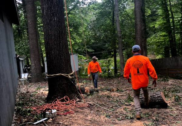
Survey the Property
At the agreed time, our expert surveyor will visit your property to carry out a thorough survey, ensuring every detail is carefully examined.
![[keyword]](https://assets.cdn.filesafe.space/uunMD7w2Gr9QA02YyNCH/media/64ad9732-c178-43ef-8c1d-548aa514b97d.png)
Post-Survey Communication!
Following the survey, we'll provide a verbal summary of key findings. Within a few days, you'll receive a detailed written report tailored to your specific surveying needs.

Need to get in touch?
Free Estimate In 3 Easy Steps
Request a Free Quote

Request a free estimate by either calling our friendly dispatch center, open 24 hours at 07871516899, or complete our short quote request form to have one of our estimators contact you to schedule a time to survey the job.
![[keyword]](https://assets.cdn.filesafe.space/uunMD7w2Gr9QA02YyNCH/media/bb0611ed-2edb-4f9d-9351-c2b7a0a26be4.png)
Get Your Survey Done!
After the job is surveyed, you will receive a written estimate outlining the job details and the cost. Just reply back with your acceptance and we'll contact you to schedule the job to be completed when it is convenient for you.
![[keyword]](https://assets.cdn.filesafe.space/uunMD7w2Gr9QA02YyNCH/media/90ed52c8-398a-43e9-9b94-ddf7001e4255.png)
Report Completion
Following the survey, we'll provide a verbal summary of key findings. Within a few days, you'll receive a detailed written report tailored to your specific surveying needs.


Monitoring Surveys
In a region shaped by mining legacy, clay soils, and evolving urban developments, monitoring surveys provide essential oversight for structural and environmental changes over time. Our specialists track subsidence in ex-colliery towns like Kirkby-in-Ashfield, crack movement in Nottingham’s Victorian terraces, and ground stability for large-scale projects like the HS2 corridor using automated prisms, tilt sensors, and 3D laser scanning. Whether safeguarding heritage buildings in Lincoln or assessing slope stability in Derbyshire’s Peak District, these surveys offer early warnings of potential risks—critical in an area where geological conditions and climate pressures demand proactive management.
"Catching millimetres of movement today to prevent metres of trouble tomorrow."
Utility Survey
Beneath the East Midlands’ streets and fields lies a hidden maze of gas pipes, fibre optics, and Victorian-era sewers—each posing risks for developers and homeowners alike. Our utility surveys use ground-penetrating radar (GPR) and electromagnetic locators to map subterranean networks with surgical precision, whether uncovering disused mine shafts in Chesterfield or avoiding Nottingham’s complex district heating system. For rural projects in Leicestershire’s farmlands or urban digs in Derby’s Cathedral Quarter, we pinpoint conflicts before they become costly mishaps—because hitting a 1800s brick culvert shouldn’t be your first clue about what lies below.
Topographic Surveying
A topographic survey provides an accurate 3D representation of any site, capturing every natural and man-made feature - from contours and vegetation to buildings, drainage systems and underground structures. Using advanced GPS technology, laser scanning and drone photogrammetry, we map sites to millimetre-level accuracy, revealing critical details like hidden elevation changes, drainage patterns and potential access issues. These surveys are indispensable for planning applications, flood risk assessments, infrastructure projects and land development, transforming raw terrain into actionable data that architects, engineers and developers rely on.
As-Built Surveys
An as-built survey documents the final constructed state of a project, confirming whether the completed work matches the original design intent. Using high-precision laser scanners, total stations, and BIM-compatible software, we capture every detail – from structural elements and utility placements to minute dimensional variances. These surveys are critical for:
Handover documentation and compliance verification
Facility management and future renovation planning
Resolving construction disputes by providing irrefutable records
Updating asset registers with exact spatial data
Particularly valuable for complex builds like industrial plants, infrastructure projects, and commercial developments, as-built surveys create a digital twin of the finished asset. This becomes the gold standard reference for all future modifications or maintenance.
Frequently Asked Questions
What is the purpose of a construction survey?
What is the purpose of a construction survey?
A construction survey ensures accurate site preparation, layout, and ongoing monitoring during building projects. It verifies design alignment, elevation levels, and boundary compliance, preventing costly errors in foundations, utilities, and structural elements.
When should I get a construction survey done?
When should I get a construction survey done?
Engage surveyors:
✔ Before breaking ground – For site analysis and design validation
✔ During construction – To monitor progress and maintain accuracy
✔ At project completion – For "as-built" verification
How does Nottinghamshire Landmark Assessments ensure survey accuracy?
We use GPS rovers, 3D laser scanning, and drone photogrammetry for millimeter precision. Our team cross-checks data against design plans, ensuring compliance with UK building regulations and client specifications.
Can surveys help avoid disputes with neighbors?
Yes! A boundary survey documents exact property lines, while party wall surveys (for terraces/semis) prevent conflicts over shared structures. These are especially useful in dense urban areas.
Contact Us
Service Hours
Social Media
Contact Us
07871516899
Brighton and Hove
Service Hours
Monday - Friday: 9 am to 5 pm
Saturday: 9 am to 4 pm
Sunday: Closed
Social Media


2025 | All Rights Reserved
Privacy Policy | Site Map